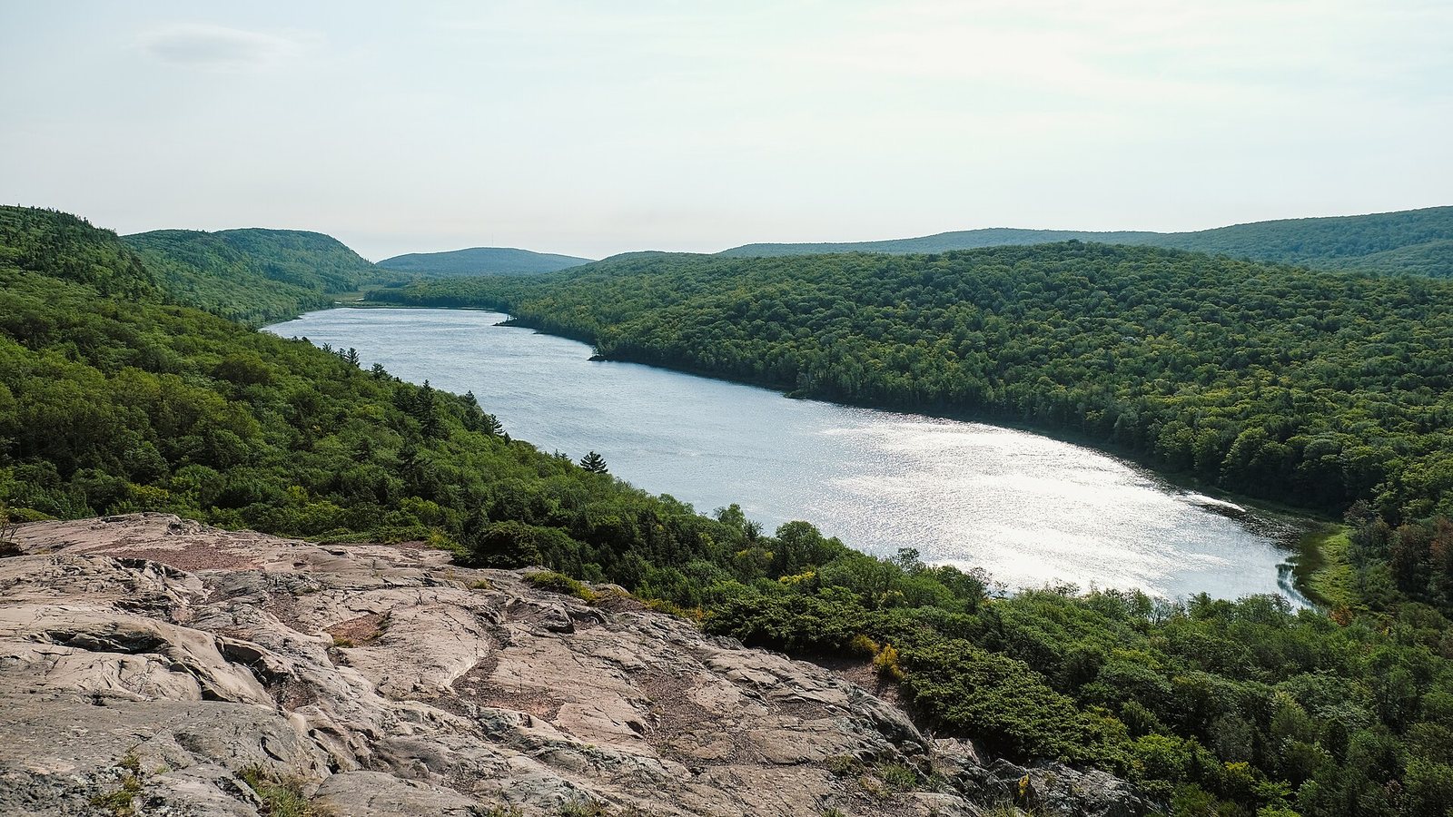
The view that sells the Porcupine Mountains takes about two minutes to reach. A short paved path from the parking lot at the end of M-107 ends at a railing on a cliff, and below it a long, narrow lake lies in a valley of unbroken forest, with the Big Carp River winding away from its far end and ridge after ridge of hardwoods rolling west toward Wisconsin. That’s Lake of the Clouds, and it’s the reason most people drive to the far western tip of the Upper Peninsula. The park around it, 59,020 acres of old-growth forest, rivers and Lake Superior shore, is the reason some of them keep coming back.
The short answer: Porcupine Mountains Wilderness State Park, “the Porkies,” is Michigan’s largest state park, on Lake Superior between Ontonagon and Ironwood. A Recreation Passport gets you in (non-residents $12 a day or $42 a year in 2026). Give it one full day for Lake of the Clouds, Summit Peak and the Presque Isle River waterfalls, or three to five days to hike, stay in a backcountry cabin or yurt, and see the Escarpment. It’s closer to Chicago, Minneapolis and Green Bay than to Detroit.
Fees, campground rules, hours and road closures below were checked on September 23, 2026 against the Michigan DNR’s park pages and the other operators’ and agencies’ own websites. Park schedules run on Eastern time, even though the gateway towns to the west run on Central; the time-zone note below explains the catch.
On this page: At a glance · Getting there · Passes and fees · Lake of the Clouds · The old-growth forest · Day hikes · Backpacking · Camping · Cabins and yurts · Staying outside the park · Presque Isle River · Paddling and fishing · Month by month · Fall color · Winter · Ironwood · Safety · Access and kids · What to bring · Itineraries · What to skip · FAQ
The Porkies at a glance
| Question | Answer (checked September 2026) |
|---|---|
| Where is it? | The northwest corner of the Upper Peninsula, on Lake Superior, in Ontonagon and Gogebic counties. The main entrance is at Silver City on M-107. |
| How big? | 59,020 acres, Michigan’s largest state park, protected since the mid-1940s |
| Entry | Recreation Passport on every vehicle: Michigan residents $15 a year with plate renewal; non-residents $12 a day or $42 a year (2026) |
| Top sights | Lake of the Clouds overlook, the Escarpment Trail, Summit Peak observation tower (1,958 feet), Presque Isle River waterfalls, Union Bay on Lake Superior |
| Trails | 90 miles, including stretches of the North Country Trail |
| Places to sleep | Union Bay modern campground, Presque Isle rustic campground (50 sites), three small outpost campgrounds, 65 backcountry sites, hike-in rustic cabins and yurts, a tiny house and a 12-person lodge |
| Visitor center | At South Boundary Road and M-107; daily 8 a.m. to 8 p.m. Eastern, mid-May to mid-October |
| Best time | July and August for hiking and camping; the last week of September and first week of October for color; January and February for skiing |
| Drive from | Chicago about 7 hours (416 mi), Minneapolis about 4 h 55 (282 mi), Green Bay about 4 h 05, Detroit about 9 h 30 (581 mi) |
| Cell service | Unreliable to absent in most of the park; Wi-Fi at the visitor center |
Where are the Porcupine Mountains, and how do you get there?
The Porkies sit at the far western end of the Upper Peninsula, on the Lake Superior shore about 20 miles west of Ontonagon and 50 miles northeast of Ironwood. The main entrance is at Silver City, a crossroads with a few motels and restaurants where M-107 heads west into the park along Union Bay. The Presque Isle River unit, at the park’s west end, is reached separately, by South Boundary Road through the park or by County Road 519 north from Wakefield.
This is a long drive from almost anywhere, and a surprising amount of it depends on where you start. Chicago drivers go north through Wisconsin and never touch the Mackinac Bridge; Detroit drivers either cross the bridge and drive the length of the U.P., or go around through Wisconsin, and it’s more than nine hours either way. Minneapolis and Duluth are the closest big cities.
| From | To Silver City (main entrance) | Notes |
|---|---|---|
| Duluth, MN | About 2 h 50 (157 mi) | East on US-2 through Ironwood |
| Green Bay, WI | About 4 h 05 (233 mi) | North through Wisconsin |
| Minneapolis, MN | About 4 h 55 (282 mi) | Ironwood is about 4 h 10 (226 mi) |
| Milwaukee, WI | About 5 h 30 (326 mi) | North through Wisconsin |
| Chicago, IL | About 7 h (416 mi) | Via Wisconsin; no bridge toll |
| Grand Rapids, MI | About 8 h 55 (528 mi) | Via the Mackinac Bridge or Wisconsin |
| Detroit, MI | About 9 h 30 (581 mi) | Via the Mackinac Bridge ($4 toll in 2026) |
| Marquette, MI | About 2 h 20 (126 mi) | West on M-28 |
| Houghton, MI | About 1 h 10 (64 mi) | The Keweenaw is an easy add-on |
| Ontonagon, MI | About 15 min (13 mi) | The nearest town with a full grocery |
| Ironwood, MI | About 55 min (50 mi) | 45 min to the Presque Isle unit |
Times are free-flow driving times without stops or traffic; add time for fuel, food and weather, and don’t count on finding gas late at night on the rural stretches. Small commercial airports in Houghton and Ironwood are each about an hour from the park, but most visitors fly into Minneapolis, Green Bay or Chicago and drive.
The time-zone catch
Michigan runs on Eastern time except four western U.P. counties on the Wisconsin line (Gogebic, Iron, Dickinson and Menominee), which run on Central. The Porkies sit right at that line: Silver City, Union Bay, the visitor center and Lake of the Clouds are in Ontonagon County on Eastern time, while Ironwood and Wakefield, the gateways to the park’s west end, are in Gogebic County on Central time. The park posts its hours in Eastern time. If you’re staying in Ironwood and driving in for a visitor-center check-in or a ranger program, add an hour.
Getting around the park
Two roads do most of the work. M-107 runs west from Silver City past Union Bay, the campground, the ski hill and the Government Peak trailhead to the Lake of the Clouds overlook, about 9 miles and 20 minutes. South Boundary Road leaves M-107 near the visitor center and winds along the park’s southern edge past the Summit Peak turnoff to the Presque Isle River, about 48 minutes from Silver City; it’s narrow and hilly, deer cross it constantly, and it’s slow going after dark. There’s no park shuttle, so backpackers doing point-to-point hikes need two cars or a second trip back to the trailhead. Trailhead parking fills on summer and fall-color weekends by mid-morning, especially at the overlook, Summit Peak and Presque Isle.
Do you need a pass for the Porcupine Mountains?
Yes. Every vehicle entering the park, including the Lake of the Clouds and Presque Isle parking lots, needs a Recreation Passport. Michigan residents buy it with their license plate renewal ($15 a year in 2026, or $5 more if bought separately). Non-residents pay $12 for a day pass or $42 for an annual pass that runs through December 31, 2026, so the annual pass wins if you’ll be in state parks on four or more days that year. You don’t need a separate hiking permit for day trips.
| What | Cost or rule (2026) |
|---|---|
| Recreation Passport, non-resident | $12 a day; $42 a year (through December 31) |
| Recreation Passport, Michigan resident | $15 a year with plate renewal |
| Campsites, cabins, yurts | Priced by site and night on MIDNRReservations.com; the Passport is still required |
| Backcountry camping | Reserve a numbered site (six months ahead up to 72 hours before), then pick up a permit in person |
| Kaug Wudjoo Lodge pets | $10 a night per pet, up to two |
| Ski hill, 2026-27 | Adult full day $60, youth $45; season pass $280 adult, $125 youth |
Overnight fees change each year and vary by site, so check the rate on the reservation site when you book. Remember that a reservation receipt isn’t a permit for the backcountry sites, outposts and cabins: you check in at the visitor center (8 a.m. to 8 p.m. Eastern, May 15 to October 15) or park headquarters (8 a.m. to 4 p.m. the rest of the year) to get the permit and keys, and late arrivals check in the next day.
Lake of the Clouds and the Escarpment
Lake of the Clouds sits in a valley between the Porkies’ main ridges, and the overlook at the end of M-107 looks straight down its length. It’s the easiest big view in Michigan: a short paved path and boardwalk lead from the parking lot to the viewing platform, the walkway is accessible, and there are color-blind viewing scopes on the platform. Come early or late in the day for softer light and a less crowded railing; on a clear day you see up the Big Carp River valley far into the western U.P. The lake has its own special fishing regulations, so read them before you drop a line.
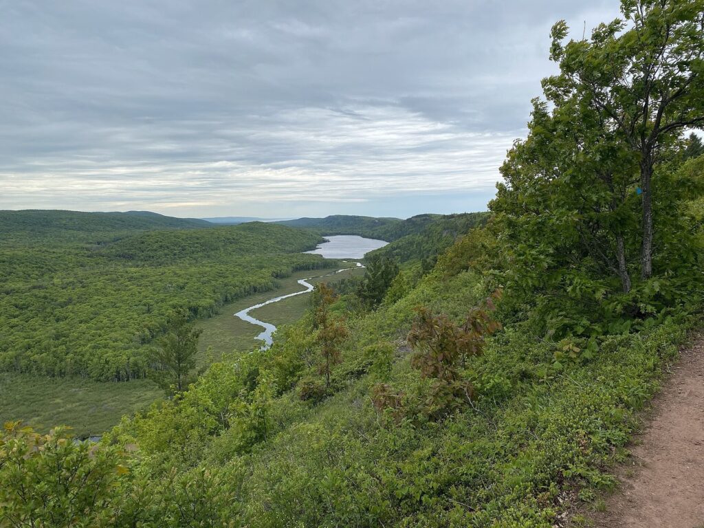
The Escarpment Trail follows the ridge east of the overlook along the cliff tops, with the lake and valley below you most of the way. The whole trail is about 8.6 miles round trip, but you can join it at three trailheads, so the best short version is an out-and-back of a mile or two from the overlook along the cliff edge. The footing is rocky and exposed in places, with steep drops close to the trail; keep children close and stay back from the edge in wind or rain.
Summit Peak, the highest point in the park at 1,958 feet, is the other high viewpoint. From the parking area off South Boundary Road, a walk of about a mile round trip leads to an observation tower that clears the treetops; on a clear day you can see Lake Superior and, in fall, an unbroken sweep of color. Between the overlook and Summit Peak, you’ve seen the park’s two best views in half a day.
The old-growth forest
The Porkies protect one of the largest tracts of old-growth northern hardwood forest left in North America: sugar maple, yellow birch, basswood and hemlock that were never clear-cut. Walking in it feels different from most Michigan woods. The trunks are huge and widely spaced, the canopy is high, and fallen giants lie rotting on the forest floor. The name comes from the Ojibwe, who saw the shape of a crouching porcupine in the ridgeline; the park lodge’s name, Kaug Wudjoo, means “place of the crouching porcupine.”
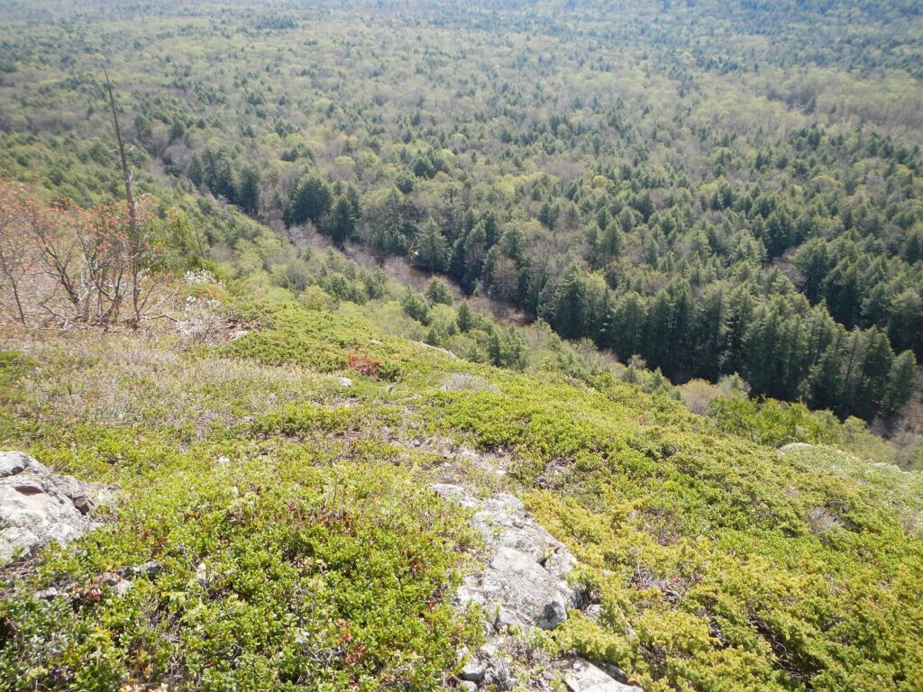
It survived partly by accident. Copper companies mined here in the late 1800s, and you can still find old shafts and ruins along the trails, but the mines were small and the rugged hills made logging hard. When timber cutting threatened the last big stands in the 1940s, conservationists pushed the state to buy the land, and it became a state park in the mid-1940s. The Union Mine Trail near the Union River is a short interpretive loop through the mining history.
Day hikes: the best trails for a short visit
The park has 90 miles of trail. For a day or two, these are the ones to do, roughly from easiest to hardest.
| Hike | Distance | What you get |
|---|---|---|
| Lake of the Clouds overlook | A few hundred feet, accessible | The park’s signature view |
| Summit Peak observation tower | About 1 mile round trip | The highest point in the park; a tower above the trees |
| Presque Isle River waterfalls | A short loop on the East and West River trails | Three waterfalls, a suspension footbridge and the river mouth on Lake Superior |
| Union Mine Trail | Short interpretive loop | Old copper-mining sites along the Union River |
| Escarpment Trail | About 8.6 miles round trip; shorter out-and-backs from the overlook | Cliff-top views over Lake of the Clouds for miles |
| Big Carp River Trail to Shining Cloud Falls | A long day or an overnight | The backcountry’s best-known waterfall on the way to Lake Superior |
With one day, drive to the Lake of the Clouds overlook first thing, walk a stretch of the Escarpment, then drive South Boundary Road to Summit Peak and on to the Presque Isle River for the waterfalls in the afternoon; it’s about 48 minutes from Silver City to Presque Isle by road. With two days, add the full Escarpment Trail (arrange a car shuttle or walk it out and back) or the Lake Superior Trail along the shore. Stop at the visitor center first for trail conditions, since storms bring down trees and bridges wash out, and pick up a paper map: you won’t have a phone signal on most trails.
Backpacking loops
For backpacking, the Porkies are the best in mainland Michigan, and a lot easier to reach than Isle Royale. The trail network connects the interior lakes and rivers with the Lake Superior shore, so most trips are loops of two to four nights built from the Lake Superior Trail, the Big Carp and Little Carp river trails, the Government Peak Trail and the trails around Mirror Lake. The rivers have waterfalls you’ll have to yourself, and several backcountry cabins and yurts sit along the routes if you want a roof.
How it works: the park has 65 numbered backcountry campsites, each with a metal fire ring, and you camp at the site you reserved. Reservations for May 15 to October 15 are strongly recommended, and they open six months ahead and close 72 hours before arrival. You then check in during business hours to collect the actual permit. Hang food in a bear bag at least 12 feet up and well out from the trunk, bury human waste in a 6-inch hole at least a quarter mile from any campsite, trail or water, and treat all water by boiling or filtering. Composting privies sit near some sites. From December 1 to May 14 you can camp anywhere in the backcountry once there’s snow on the ground, after registering at park headquarters.
Trail difficulty is real: long climbs off the escarpment, roots, mud in June and river crossings that change with the season. Plan on shorter daily distances than you would on flat Lower Peninsula trails, and check at the visitor center which bridges are out before you commit to a loop.
Camping: campgrounds, outposts and group sites
The Porkies have a campground for every style, from electric sites with showers to rustic sites with a hand pump. All of them need a Recreation Passport on the vehicle, and summer weekends book up; reserve through MIDNRReservations.com as early as you can.
| Campground | Type | Sites | What’s there |
|---|---|---|---|
| Union Bay | Modern | Tent to large RV | The park’s only electric sites, a toilet and shower building, sanitation station, boat launch and camp store; some sites on the Lake Superior shore, with a sandy beach a short walk away |
| Presque Isle | Rustic | 50, including 6 walk-in | Vault toilets and hand pumps near the Presque Isle River; walk-in sites on the high bank above Lake Superior; one loop generator-friendly, one generator-free |
| Lost Creek Outpost | Rustic | 3 | Near the Lost Lake trailhead; vault toilet, no water |
| White Pine Extension Outpost | Rustic | 8 | A couple of miles from Summit Peak; vault toilet, no water |
| Union River Outpost | Rustic | 3 | On a classic U.P. trout stream; vault toilet, no water |
| Group sites | Rustic | 2, up to 24 people each | Near the Union Bay beach; intended for youth and civic groups |
| Backcountry | Primitive | 65 | Hike-in, numbered sites; permit required |
Outpost sites suit tents, vans and small campers, and you have to check in in person for permits and keys; you can’t arrive before 3 p.m. Water for the outposts comes from park headquarters or the visitor center. The Wilderness Supply Store near the Union Bay entrance sells supplies and firewood and rents canoes and kayaks for paddling Union Bay when the lake is calm.
Rustic cabins, yurts and the lodge
Staying in a Porkies cabin is the classic trip here, and the best way to feel how remote the park is. The rustic cabins sleep two to eight people and come with bunks and mattresses, a wood stove, a table, an axe, a bow saw and basic cookware, including a percolator. There’s no running water or electricity; a vault toilet stands nearby, and you bring your own sleeping bags, towels, toilet paper and lights. Every cabin is near water, and the ones on inland lakes come with a boat and life jackets. All but two require a hike in, from 100 yards to 9 miles, and from mid-November through May you’ll need snowshoes or skis to reach them. One cabin, Whitetail, is closed after a fire until repairs are made.
The wilderness yurts sleep four with the same basic setup and a shorter walk, from 100 yards to 2.5 miles; all but the Lost Creek yurt allow pets. For more comfort, the Tiny Quill House inside Union Bay Campground sleeps four with electricity, a small kitchen and an accessible ramp. The Kaug Wudjoo Lodge, the park manager’s original residence on the Lake Superior shore, sleeps 12 in four bedrooms, with a full kitchen, laundry, Wi-Fi and a stone fireplace; it takes up to two pets at $10 a night each, requires a seven-night minimum from May through November (four nights in winter) and is booked by phone at 906-885-5275.
Cabins and yurts go early for summer weekends and the fall-color weeks, so book as far ahead as the reservation system allows. Pack for insects from late May through July, boil or filter all water, carry out everything you bring in, and never burn trash in the stove.
Where to stay outside the park
If you’d rather have a bed and a shower, there are three bases. Silver City, at the park entrance, has a handful of motels, lodges and cabins, some on the Lake Superior shore, and puts you 20 minutes from the Lake of the Clouds overlook. Ontonagon, 15 minutes east, is a small harbor town with more motels, a grocery store, gas and restaurants. Ironwood and Wakefield, about an hour southwest on the Wisconsin line, are the Gogebic Range towns: more rooms, the ski resorts and the waterfalls of the Black River, and a 45-minute drive to the Presque Isle end of the park.
Nightly rates vary by site and show only at booking, but the pattern is simple. Rooms are cheapest in spring and midweek summer, tighter and pricier in July, August and the fall-color window, and busy again in ski season in Ironwood and around the ski hills. Many small places close in the shoulder months or keep short hours, so confirm before you drive up in April, November or early December.
The Presque Isle River waterfalls
At the park’s west end, the Presque Isle River drops through a gorge of tilted black rock in a series of falls and rapids before it reaches Lake Superior. A short loop on the East and West River trails, linked by a suspension footbridge near the river mouth, passes the three main falls: Manabezho, the widest, then Manido and Nawadaha upstream. An accessible observation platform overlooks Nawadaha Falls on the West River Trail. The water is stained the color of tea by tannins from the forest, and in spring runoff the whole gorge roars.
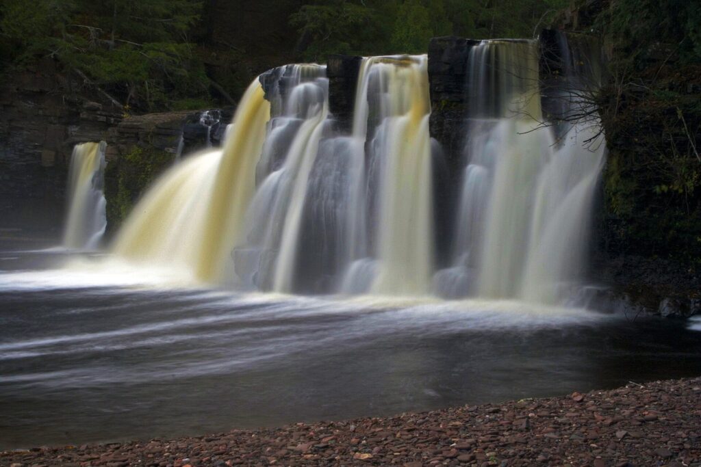
From Silver City it’s about 48 minutes to the Presque Isle parking area by South Boundary Road, past Summit Peak; from Ironwood, it’s about 46 minutes by County Road 519 from Wakefield, which is also the only way in when the park roads close for winter. Stay on the trails and off the wet rock: the falls are powerful, the rock is slick and the pools have strong currents. For the waterfalls of the Black River Scenic Byway near Ironwood, allow another half day.
Paddling, fishing and the rest
Paddling
Union Bay is the park’s paddling water: launch from the boating access site next to the campground, where there’s also an accessible fishing pier, and follow the shore on a calm morning. The Wilderness Supply Store near the campground entrance rents canoes and kayaks from late May to mid-October. A second Lake Superior launch sits at the mouth of the Big Iron River in Silver City. Treat the big lake with respect. Wind and waves build quickly on this exposed coast, the water is cold enough to incapacitate a swimmer in minutes, and much of the shore is rock with few places to land, so stay close in and turn back early. The inland lakes are gentler, and the backcountry cabins on them come with a boat.
Fishing
Brook trout live in streams throughout the Porkies watershed, and the Union River and the Carp rivers are classic small U.P. trout water; Lake of the Clouds has special fishing regulations, so read them before you fish there. Lake Superior is reachable from the Union Bay and Big Iron River launches or from the fishing pier. Anglers 17 and older need a Michigan license; the DNR’s 2026 figures are $76 for a non-resident all-species annual license and $10 for a 24-hour license, sold online.
Also in the park
The Porkies have a free 18-hole disc golf course, open late May to mid-October, with discs for rent at the campground store. Seasonal naturalists run nature programs in summer and fall (check the park’s explorer program calendar), the Bear Necessities gift shop is open from late May to mid-October, and the Porkies Music Festival takes over part of the park for a weekend each summer. There’s also a shooting range, run by the Lake Superior Sportsman’s Club, which charges its own annual membership on top of the Recreation Passport. Registered campers may metal detect in the campgrounds. In winter, the park roads become snowmobile trails, linking the park into the western U.P.’s trail network.
When to go: the Porkies month by month
| When | What it’s like | Good for |
|---|---|---|
| April | Snowmelt, mud and high rivers; snow lingers in the woods on high ground | Waterfalls at full flow from the Presque Isle trails |
| May | Cool and quiet; the visitor center opens mid-month; black flies start late in the month | Waterfalls, wildflowers, empty trails |
| June | Long days, green forest and the worst of the bugs | Hiking with a head net, early-summer camping |
| July and August | The warmest and busiest months; campgrounds and cabins full | Backpacking, camping, paddling Union Bay, the music festival |
| September | Fewer people and fewer bugs; color starts late in the month | Backpacking, the start of the color |
| Early October | Peak color in most years; crowds at the overlook; the visitor center closes mid-month | Lake of the Clouds, Summit Peak, the fall chairlift |
| November | Gray, cold and very quiet; firearm deer season runs November 15 to 30 | Solitude, with blaze orange on the trails |
| December to March | Deep lake-effect snow; M-107 and South Boundary Road close to cars from December 1 | Downhill and cross-country skiing, snowshoeing, winter cabins |
The sweet spot for most visitors is late August into September: warm enough to camp, past the bug season, and before the fall-color traffic. If you’re coming for Lake of the Clouds in color, aim for the last few days of September or the first week of October, and book lodging months ahead.
When is peak fall color in the Porcupine Mountains?
The western U.P. turns first in Michigan, and the Porkies usually peak around the last week of September and the first week of October; searches for the park peak the week of September 28 to October 4. UP Travel’s fall color report, updated every Wednesday in season, expected the western U.P. counties to peak in the last week of September and first week of October in 2026. The old-growth maples go red and orange, the birch and aspen yellow, and the hemlocks stay dark green, which is what makes the view from the overlook look painted.
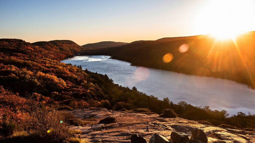
Color weekends are the busiest days of the year at the overlook, so go early, midweek if you can. Ride the fall chairlift at the ski hill for a view over the forest to Lake Superior, climb the Summit Peak tower, and drive South Boundary Road slowly. For how the Porkies fit into a statewide trip, see our Michigan fall color tour guide, which has peak timing for every region.
The Porkies in winter
Winter changes the park. From December 1 until late spring, M-107 beyond the Whitetail parking area and South Boundary Road (from Headquarters Road south to the Pinkerton Trailhead) close to cars and become designated snowmobile trails, and the Lake of the Clouds overlook becomes a ski, snowshoe or snowmobile trip. The Presque Isle River unit stays reachable by car on County Road 519 from Wakefield.
The Porcupine Mountains Winter Sports Complex, the DNR-run ski hill on the park’s east side, is the draw. Skiresort.com lists 192 meters (about 630 feet) of vertical, three lifts and just under 10 kilometers of runs, with views of Lake Superior from the top, and it’s one of the few ski hills where you look down on a Great Lake. For 2026-27 a full-day adult ticket is $60 and a youth ticket $45, the first price increase since 2018; season passes are $280 for adults and $125 for youth. The park also grooms 42 kilometers of cross-country ski trails (donations pay for the grooming) and lends adaptive sit skis for children, teens and adults at the ski chalet; call ahead.
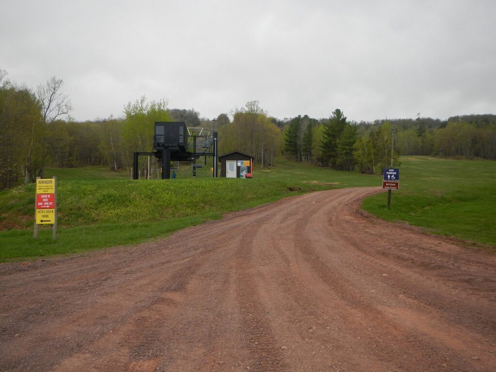
Cabins and yurts stay open in winter with firewood provided for heat, and you’ll ski or snowshoe in. Lake-effect snow off Lake Superior is heavy and frequent, so carry a winter kit in the car, expect slow roads, and check the park’s winter updates or call 906-885-5275 before you go.
Ironwood and the Gogebic Range
Ironwood is the base for the western end of the park and the biggest town in this corner of the U.P., right on the Wisconsin line on US-2 and on Central time. It grew up as an iron-mining town on the Gogebic Range, and its old downtown shows it. Its best-known landmark is a giant statue of Hiawatha, a roadside figure from the 1960s on the hill above downtown.
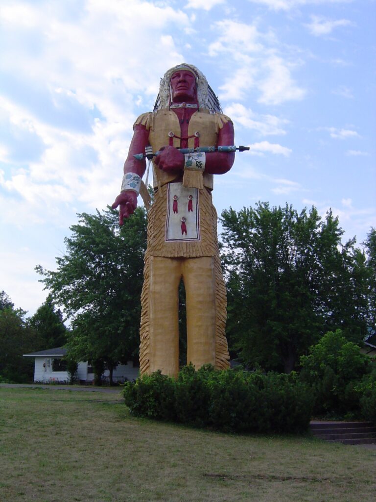
North of town, Copper Peak is the only ski-flying hill in the Western Hemisphere, a steel ramp on top of a hill. In 2026 its Adventure Ride, a chairlift up the 800-foot hill and an 18-story elevator to an observation deck with views over about 2,500 square miles, runs on Sundays only, 9:30 a.m. to 4:30 p.m. Central, because of construction on a rebuild meant to make it the world’s largest artificial ski jump, usable year-round. The nearby Black River Scenic Byway runs past a chain of waterfalls to Black River Harbor on Lake Superior. In winter, Big Powderhorn and Snowriver, which joins the Ikon Pass for 2026-27, make the Gogebic Range one of the U.P.’s main ski areas, and Lake Gogebic, to the east, straddles the time-zone line.
Safety: bears, bugs, no signal and Lake Superior
The Porkies are wild country, and most problems here come from not taking that seriously.
- Black bears live throughout the park. Keep a clean camp, store food in a hard-sided vehicle or hang it at least 12 feet up and out from the trunk, never keep food in your tent, and give any bear plenty of room.
- Bugs are worst from late May through July: black flies, mosquitoes and deer flies. Bring repellent, a head net and long sleeves, and check for ticks after hiking.
- No signal. Cell service is unreliable to absent on most trails. Carry a paper map or download the park’s GPS map for the Avenza app, tell someone your route, and check trail conditions at the visitor center.
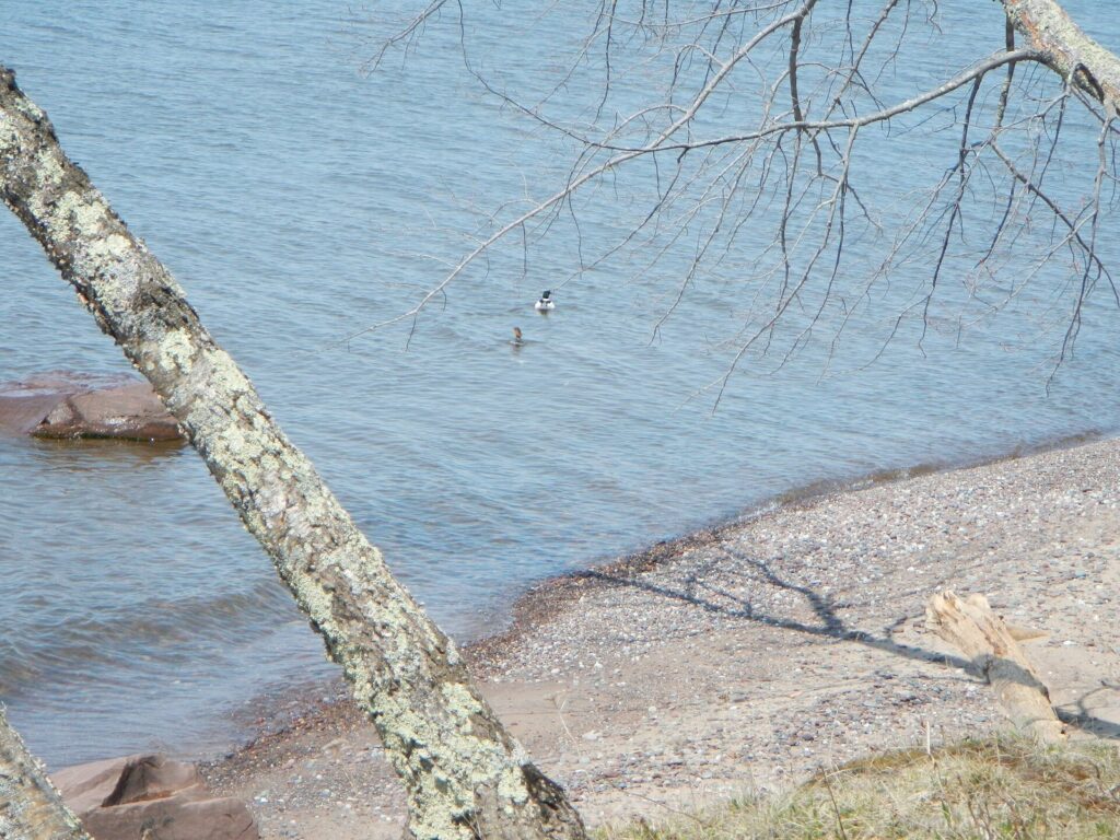
- Lake Superior is cold enough in summer to cause cold shock, and waves build fast on the exposed shore. Stay off wet shoreline rock in surf, don’t swim near river mouths after rain, and watch children on the beach at Union Bay.
- Water from any lake or stream needs boiling for a minute or filtering through a 0.5-micron filter.
- Help is far away. The closest hospital, in Ironwood, is up to an hour from parts of the park. For emergencies, call 911 if you can get a signal; ambulance service covers Ontonagon County.
- Weather turns quickly on the escarpment and the lakeshore. Carry rain gear and a warm layer even in August, and allow for early dark in fall.
Accessibility and visiting with kids
For a wilderness park, the Porkies do well on access. The walkway and viewing platform at the Lake of the Clouds overlook are accessible, and so is an observation platform over Nawadaha Falls on the Presque Isle River’s West River Trail. Color-blind visitors can borrow the view through EnChroma scopes at the overlook, the Summit Peak tower and Nawadaha Falls. The Tiny Quill House in Union Bay Campground has a ramp, there’s an accessible fishing pier at the Union Bay launch, and in winter the ski chalet lends adaptive sit skis in child, teen and adult sizes (call ahead). The Summit Peak tower, the Escarpment Trail and the backcountry are not accessible.
With children, build the trip around short walks and the beach. The sandy stretch of Union Bay near the campground, the visitor center’s exhibits and multimedia show, the free disc golf course and the summer nature programs all work for younger kids, and the Presque Isle waterfall loop is short enough for most school-age hikers. Hold hands at the overlook and on the Escarpment, where the cliff edge is close to the trail, and keep everyone off the wet rock at the falls. A hike-in yurt with a short approach makes a good first night in the woods.
What to bring
The nearest full grocery store is in Ontonagon, and the park is a long way from outdoor shops, so arrive with what you need.
- For day hikes: sturdy boots (the trails are rocky and rooty), rain gear and a warm layer in any month, water and a filter, bug repellent and a head net from late May through July, a paper map or an offline GPS map, and a headlamp in fall when the light goes early.
- For cabins and yurts: sleeping bags and pads or sheets, towels, toilet paper, lights and a lantern, food, a water filter or pot for boiling, matches and dry kindling. The cabins supply the stove, bunks, axe, saw and basic cookware.
- For backpacking: a bear bag and at least 50 feet of rope (you’ll hang it 12 feet up), a trowel for waste, a water filter, and your reservation details for the permit check-in.
- For winter: snowshoes or skis for cabin access, a real winter sleeping bag, and a car kit with a shovel, blanket and extra food.
- Firewood: buy it locally, at the campground store or near the park, rather than bringing it from home; moving firewood spreads forest pests. In the backcountry, use only dead and downed wood.
Sample Porcupine Mountains itineraries
One day
Start at the visitor center when it opens at 8 a.m. Eastern, then drive to the Lake of the Clouds overlook before the crowds and walk a mile or two along the Escarpment. Drive South Boundary Road to Summit Peak for the tower, then on to the Presque Isle River for the waterfall loop and a picnic at the river mouth. Head back the same way, or exit south on County Road 519 toward Wakefield and Ironwood.
Three days
Day one: the overlook, the full Escarpment Trail and sunset on Union Bay. Day two: Summit Peak, the Union Mine Trail and the Presque Isle waterfalls, with a night in a cabin or yurt near the road. Day three: a long hike on the Lake Superior Trail or the Big Carp River Trail, then a drive to Ontonagon for dinner, or on to Copper Peak and the Black River waterfalls if it’s a Sunday.
A week
Backpack a three- or four-night loop through the interior, linking the Lake Superior shore with the Big and Little Carp rivers and Mirror Lake, with a cabin night in the middle. Spend the rest of the week on day trips: the Keweenaw is an hour and a quarter to Houghton and two hours to Copper Harbor, and the Gogebic Range waterfalls and Copper Peak are an hour southwest.
Adding the rest of the western U.P.
Most people who drive this far combine the Porkies with a second stop. The Keweenaw Peninsula is the natural pairing: Houghton is about 1 hour 10 minutes northeast, and Copper Harbor, at the tip, about 2 hours. From Houghton, the Park Service’s Ranger III sails to Isle Royale in about six hours ($80 one way per adult in 2026), and from Copper Harbor the Isle Royale Queen IV makes the crossing in about three and a half ($175 round trip), both from mid-May through September. To the east, Marquette is about 2 hours 20 minutes away on M-28, and Pictured Rocks lies beyond it. To the southwest, Ironwood’s waterfalls and Copper Peak make a good last day before the drive home through Wisconsin.
What to skip, and what to do instead
Skip the overlook at midday on a peak color weekend. Go at sunrise or late afternoon, or on a weekday, and spend midday on the trails.
Skip the drive from Detroit for a single day. It’s more than nine hours each way. Plan at least three nights, or combine the Porkies with the Keweenaw or Pictured Rocks.
Skip showing up for a cabin or backcountry site without a reservation in summer or early October, and don’t forget that the reservation receipt isn’t a permit: check in during business hours.
Skip the Presque Isle rocks when the river is high. Watch the falls from the trail and the platforms; a slip into the current can be fatal.
Skip June if bugs ruin a trip for you. Late July through early October is far kinder.
Skip trusting your phone. Download maps before you arrive and carry a paper one.
Frequently asked questions
Where is the Porcupine Mountains in Michigan?
The Porkies are at the western end of Michigan’s Upper Peninsula, on the Lake Superior shore in Ontonagon and Gogebic counties. The main entrance is at Silver City on M-107, about 20 miles west of Ontonagon and 50 miles northeast of Ironwood. From Chicago it’s about seven hours by road through Wisconsin; from Detroit it’s about nine and a half.
Do you need a pass for the Porcupine Mountains?
Yes. Every vehicle needs a Michigan Recreation Passport, including at the Lake of the Clouds and Presque Isle parking lots. Michigan residents add it to their plate renewal for $15 a year; non-residents pay $12 a day or $42 a year (2026 prices). Campsites, cabins and yurts cost extra, and backcountry campers need a permit picked up in person.
How long is the drive to Lake of the Clouds?
From the park entrance at Silver City, the overlook is about 9 miles and 20 minutes up M-107, and the walk from the parking lot to the viewing platform takes a couple of minutes on a paved, accessible path. From Ontonagon, allow about 35 minutes; from Ironwood, about an hour and a quarter. M-107 beyond the Whitetail parking area closes to cars from December 1 until late spring.
What is the best hike in the Porcupine Mountains?
The Escarpment Trail is the best-known hike: about 8.6 miles round trip along the cliff tops above Lake of the Clouds, with views for much of the way, and you can do a shorter out-and-back from the overlook. For waterfalls, the short loop on the Presque Isle River is the pick, and Summit Peak’s tower is the easiest big view after the overlook.
When is peak fall color in the Porcupine Mountains?
Usually in the last week of September and the first week of October, among the first places in Michigan to peak. UP Travel’s 2026 outlook expected the western U.P. to peak in that window. Color weekends are the busiest time at the Lake of the Clouds overlook, so arrive early, and book any cabin, yurt or motel room well ahead.
Can you stay overnight in the Porcupine Mountains?
Yes, in many ways: Union Bay’s modern campground, the 50-site Presque Isle rustic campground, three small outpost campgrounds, 65 hike-in backcountry sites, hike-in rustic cabins and yurts, a tiny house and the 12-person Kaug Wudjoo Lodge. Reserve through the DNR’s reservation site, and check in in person for backcountry, outpost and cabin permits. Motels are in Silver City and Ontonagon.
Are there bears in the Porcupine Mountains?
Yes, black bears live throughout the park, and campers must protect their food: hang bear bags at least 12 feet up and away from the trunk, or keep food in a hard-sided vehicle, and never store it in your tent. Bears here usually avoid people. Keep a clean camp, make noise on the trail, and give any bear you see plenty of room.
Sources and verification
Everything on this page was checked on September 23, 2026 against the organizations listed here. This guide is compiled from those sources; it doesn’t claim first-hand visits.
- Michigan DNR: Porcupine Mountains Wilderness State Park, covering campgrounds, cabins, yurts, the lodge, the visitor center, winter roads and backcountry rules
- Porcupine Mountains Winter Sports Complex: tickets and passes, plus the DNR’s 2026-27 rate announcement
- UP Travel: Porcupine Mountains, plus its Summit Peak and Escarpment Trail listings and its fall color report
- Copper Peak for the 2026 Adventure Ride schedule
- MIDNRReservations.com for booking campsites, cabins and yurts
Also checked: the Michigan DNR’s Recreation Passport page; the Porcupine Mountains visitor bureau (porcupineup.com); skiresort.com’s ski area data; Detroit News reporting on the Copper Peak rebuild; and drive times from a routing service.
Michigan Tourism Guide is an independent publication. It is not affiliated with Pure Michigan or any agency or business named here.
Photo credits
- Lake of the Clouds from the escarpment (featured image): photo by Sharon Mollerus, Wikimedia Commons (CC BY 2.0)
- Big Carp River and Lake of the Clouds from the Escarpment Trail: photo by Fondycardinals, Wikimedia Commons (CC BY-SA 4.0)
- Old-growth forest from the ridge: photo by Curtis Abert, Wikimedia Commons (CC BY 2.0)
- Manabezho Falls, Presque Isle River: photo by U.S. Fish and Wildlife Service – Midwest Region, Wikimedia Commons (public domain)
- Lake of the Clouds in fall: photo by Stevenliuyi, Wikimedia Commons (CC BY-SA 4.0)
- The Porkies ski hill in spring: photo by Curtis Abert, Wikimedia Commons (CC BY 2.0)
- Hiawatha statue, Ironwood: photo by Ian Shackleford, Wikimedia Commons (CC BY 3.0)
- Lake Superior shore in the park: photo by Curtis Abert, Wikimedia Commons (CC BY 2.0)